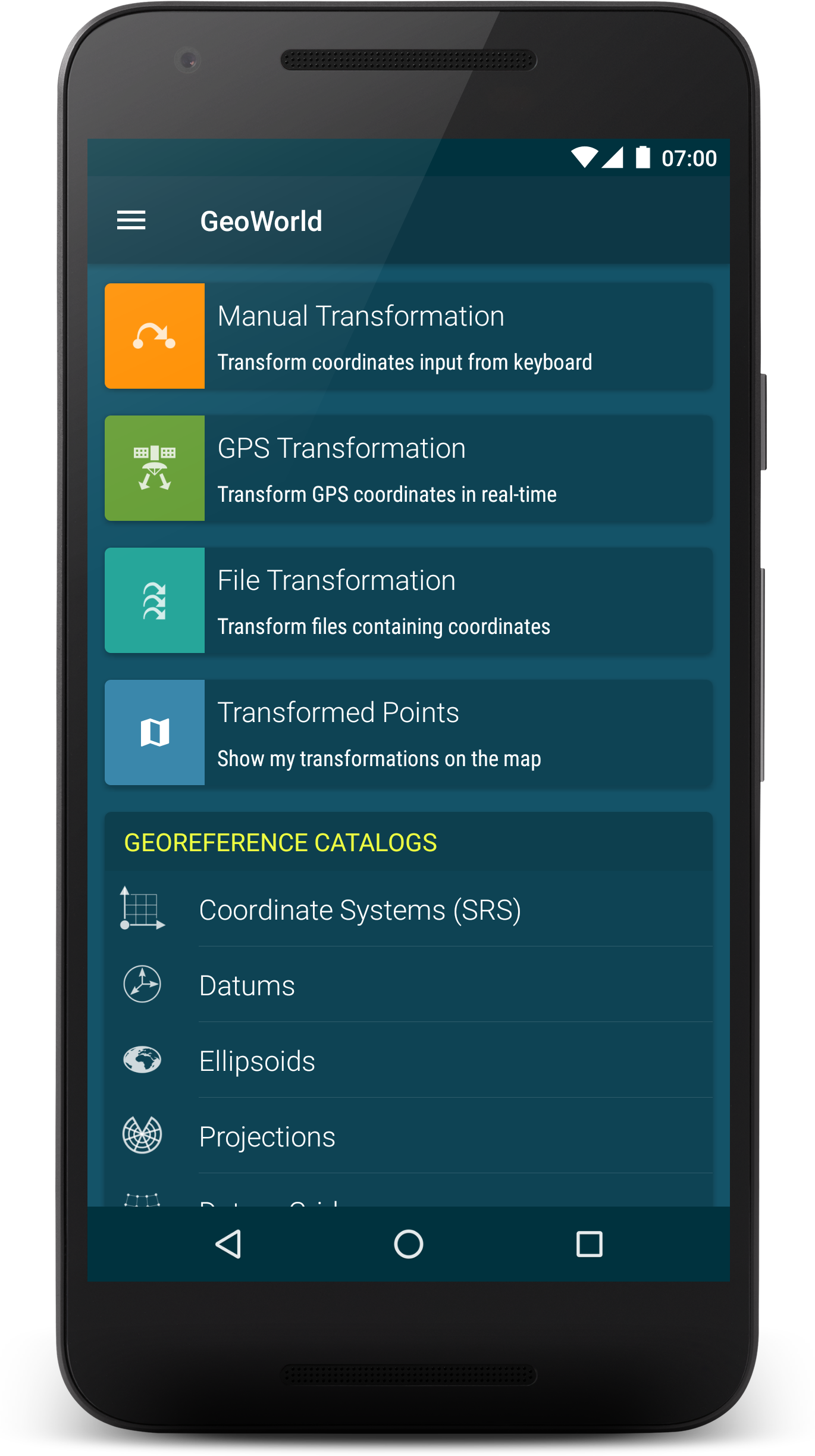
GeoWorld
Android geocoordinate converter and data collection tool for geodesists and field surveyors. Offers unique features on the market. Converts coordinates from manual input, GPS or TXT/CSV files from/to practically all geodetic coordinate systems. Offers full customization of all coordinate transformation parameters. Based on Spatialte / Proj4 DB and a built-in EPSG dataset. Play Store
-
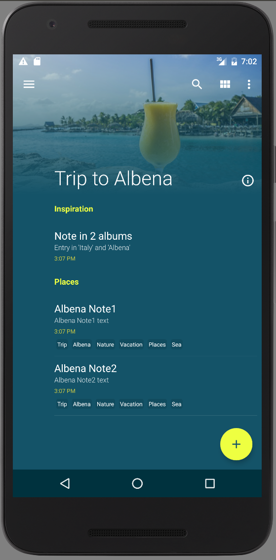
Notes organized in Albums
Implemented with Spatialite, GreenDAO, MVVM, Data Binding, RecyclerView, CoordinatorLayout. Features: multi-selection mode, animated search, placeholders, tags, categories, grouping by title and date, list/grid/staggered grid, item geolocation.
-
Circular reveal/shrink animation
-
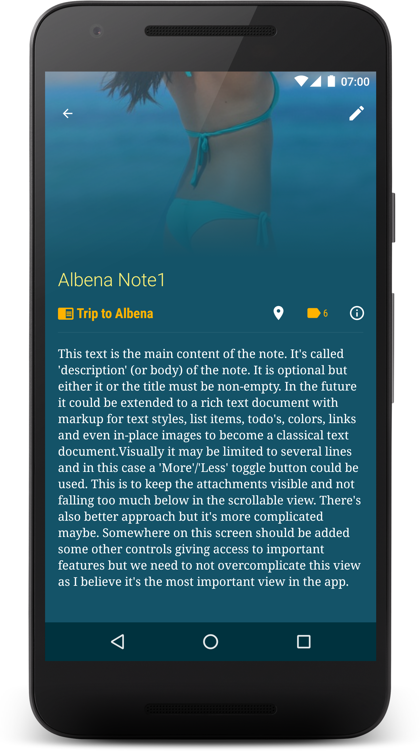
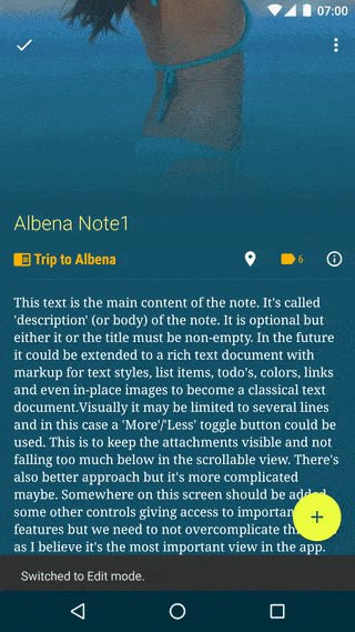
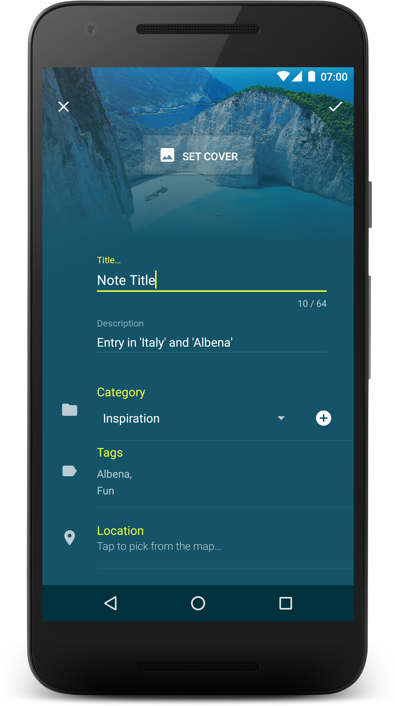
Note editor
Adding category, tags, cover image and geolocation.
-
Main screen
Dashboard with CardView’s.
-
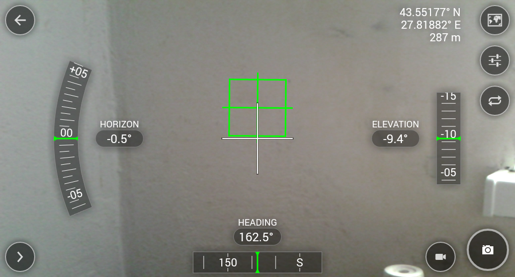
Camera + sensors + GPS
Immersive camera activity displaying smooth roll, pitch and compass values from sensors.
-
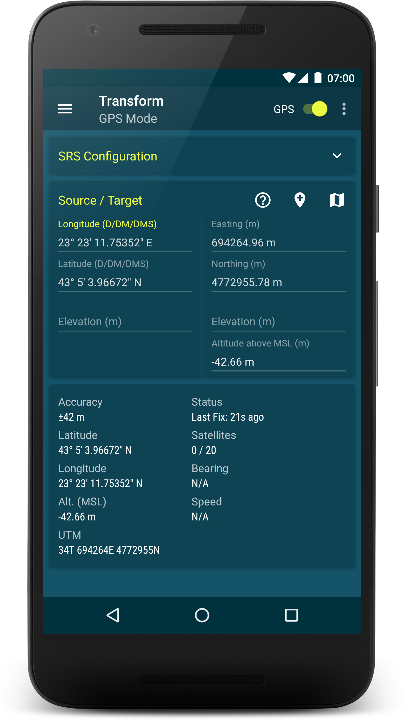
GPS
Coordinates converted realtime.
-
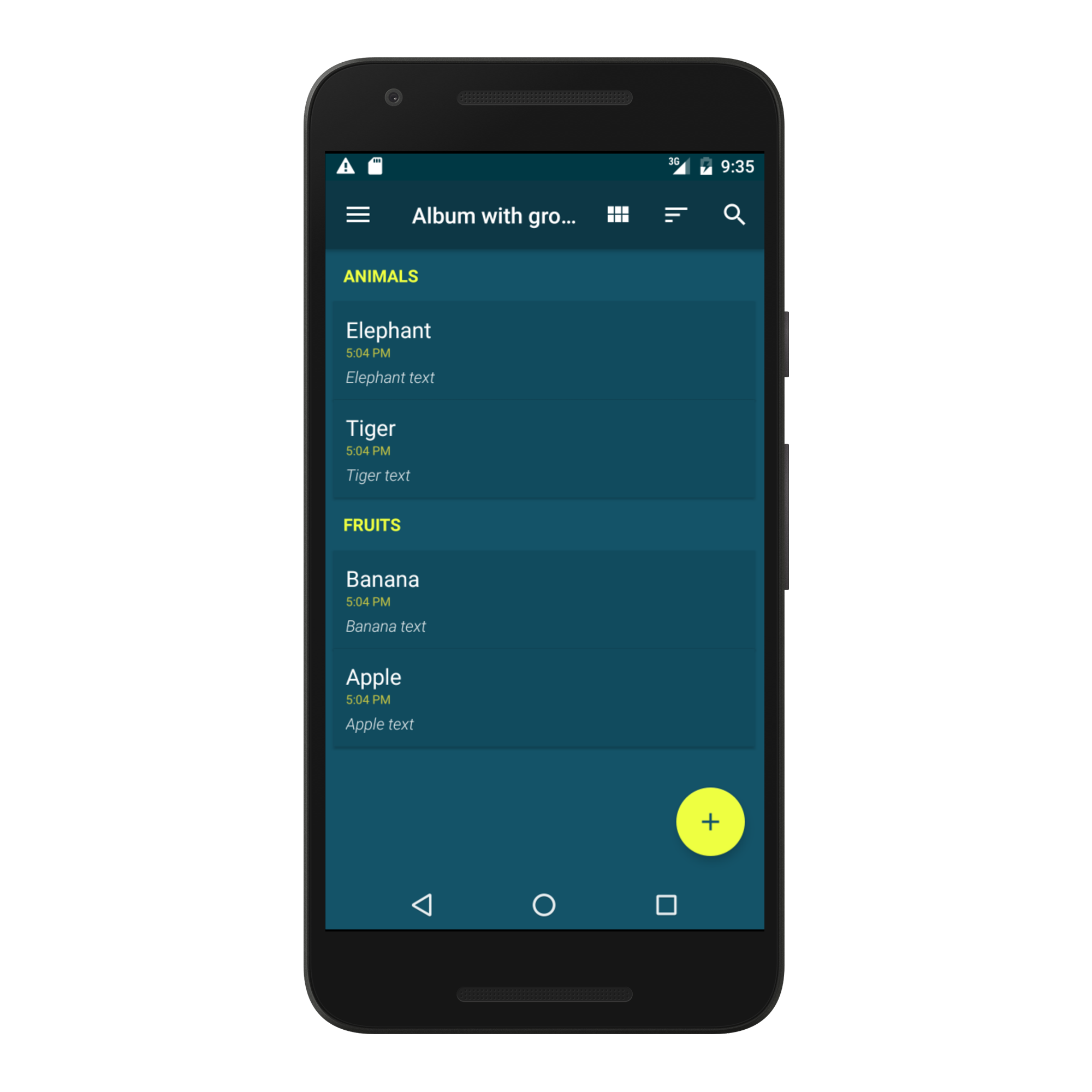
Grouped notes
Self-sectionizing RecyclerView with MVVM / Data Binding. Item sections are automatically and transparently generated from the items dataset by a grouping function and comparator. It produces alphabetical, chronological, file-size and other types of section buckets. View modes: List, Grid, Staggered Grid.
-
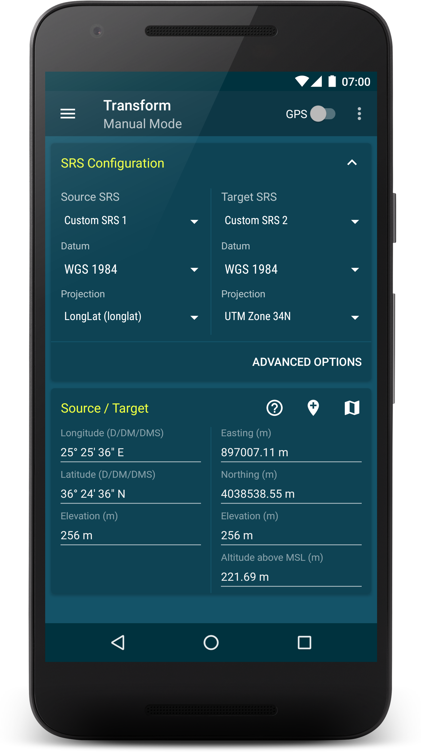
Manual coordinates conversion
-
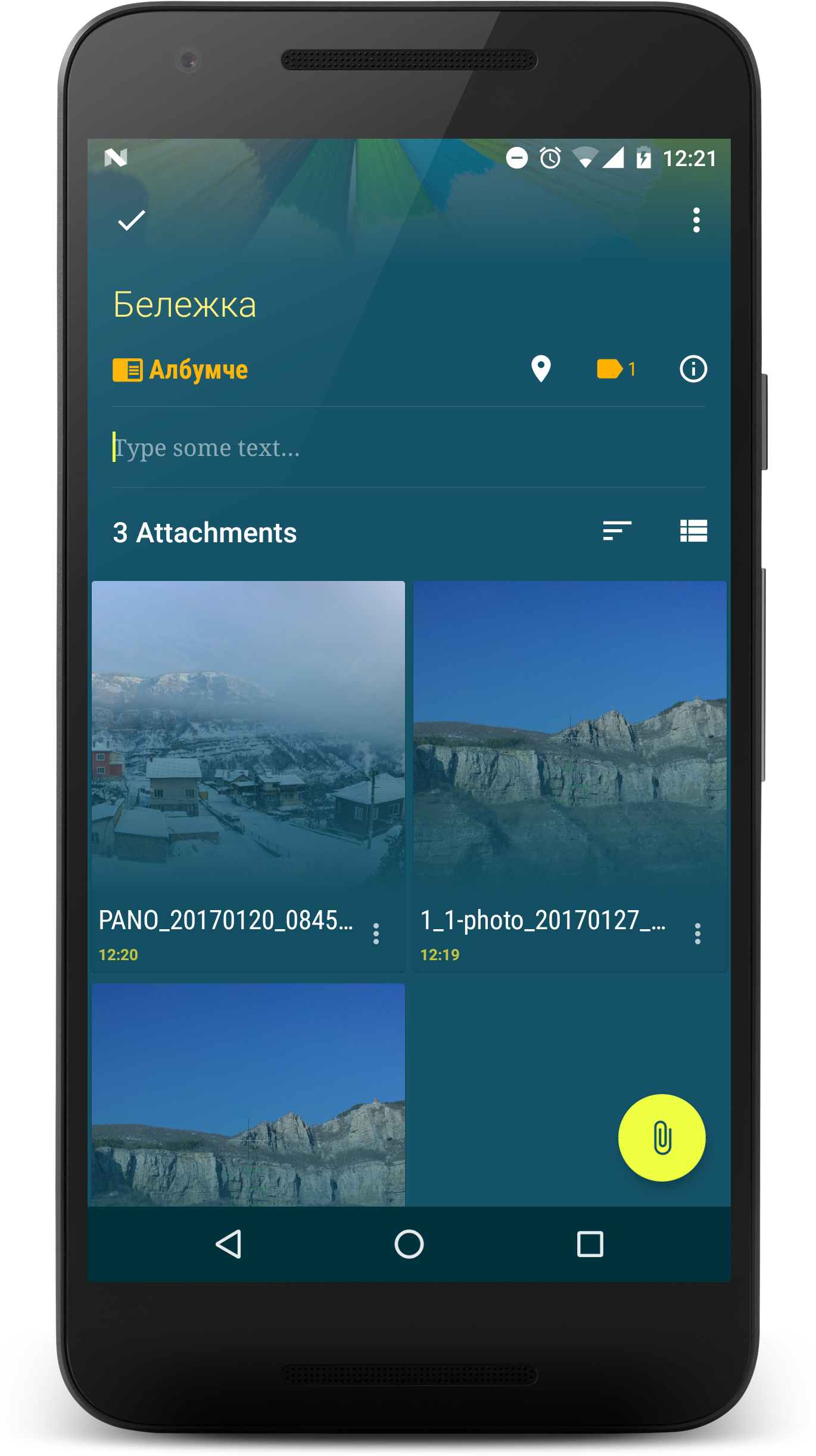
Note attachments
Attaching image, videos and documents to a note. Copied by a background Service and stored in file ContentProvider. List/Grid view mode. Sorting options.
-
Note properties
-
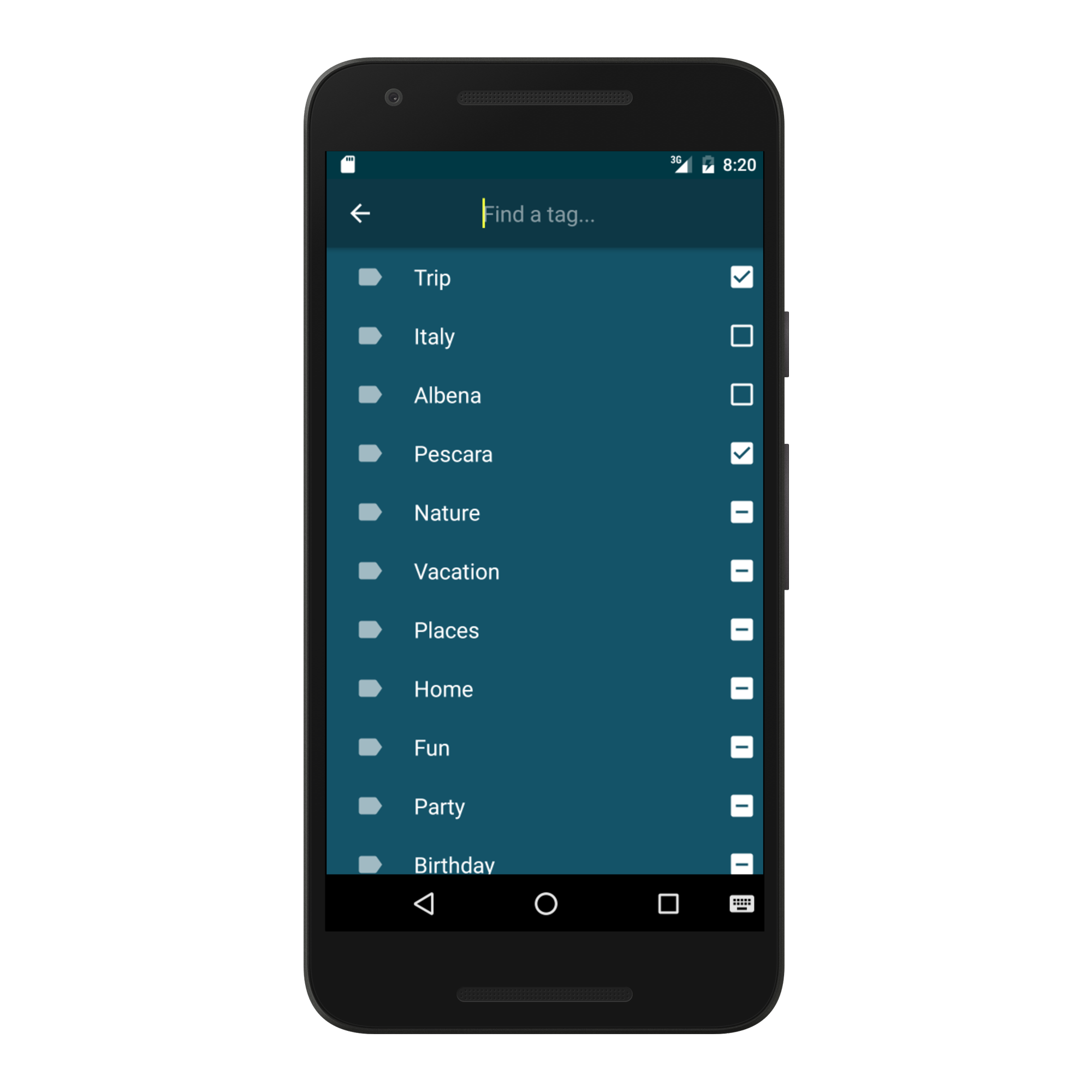
Tag manager
Note tags with a custom 3-state CheckBox.
-
Notes organized in Albums
Implemented with Spatialite, GreenDAO, MVVM, Data Binding, RecyclerView, CoordinatorLayout. Features: multi-selection mode, animated search, placeholders, tags, categories, grouping by title and date, list/grid/staggered grid, item geolocation.
-
Circular reveal/shrink animation
-
Note editor
Adding category, tags, cover image and geolocation.
-
Main screen
Dashboard with CardView’s.
-
Camera + sensors + GPS
Immersive camera activity displaying smooth roll, pitch and compass values from sensors.
-
GPS
Coordinates converted realtime.
-
Grouped notes
Self-sectionizing RecyclerView with MVVM / Data Binding. Item sections are automatically and transparently generated from the items dataset by a grouping function and comparator. It produces alphabetical, chronological, file-size and other types of section buckets. View modes: List, Grid, Staggered Grid.
-
Manual coordinates conversion
-
Note attachments
Attaching image, videos and documents to a note. Copied by a background Service and stored in file ContentProvider. List/Grid view mode. Sorting options.
-
Note properties
-
Tag manager
Note tags with a custom 3-state CheckBox.